of oslo.town
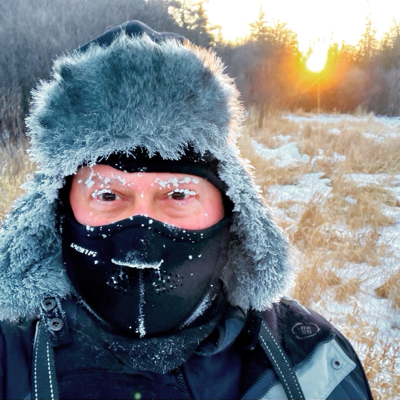
Allez, un autre petit 15-20cm qui s’en viennent. Bon week-end la gang.

Allez, un autre petit 15-20cm qui s’en viennent. Bon week-end la gang.
I navigated my morning toilet and the scary porch steps unaided. Dismal Minion Wrangler was standing by with the beach blanket of rescue. He loops in under my belly and helps me up wheelbarrow-style. Much better than being carried up like a sack of kibble. #greyhounds #DoneGotOl #SnowStorm


Missy went out around 2030. Snow is hock deep. She motored around unassisted and scaled the steps unassisted. #greyhounds #SnowStorm

A truck mishap closed the Chesapeake Bay Bridge Tunnel for 6 hours overnight. Frozen chicken everywhere.
Mess is cleaned up and roadway open until the snow starts.
Again, a reminder to AKQ AOR residents to not drive in the storm, especially Wednesday night and Thursday.
The snow will accumulate to depths that will pack under the vehicle. The drag and lift will immobilize the vehicle. I’ve experienced this personally. Fortunately only 2 blocks from my office with a card key in my pocket. I weathered the storm there until later when a coworker and I could dig my 280Z out.
It’s like running aground in a boat. But waiting for spring not tide.
Wait for it. Boffins promise by 0900R Wednesday, their latest prophecies will be posted. They generally post the slide decks used to brief local emergency managers.
Please take this storm seriously. We had many of these when I lived in CT. If the state and city have plows and overtime money, they’re no big deal. Most municipalities had their primary streets drivable a few hours after the snow stopped, typically 4-8. Life went on.
VA snow removal plan — wait for spring
Been there, done that, got the tee-shirt. Walked back to the office and sheltered there. #VAwx #SnowStorm
NWS Wakefield has updated the snow storm forecast. The entire AOR is now storm warned. This is a normal snow storm! Well, not for here but not a blizzard.
The snow will be deeper than most vehicles’ ground clearance. If you try to drive in deep snow, the snow causes drag trapping the vehicle.
This storm will strand those foolish to venture out into into deep snow. Nothing, nothing will be plowed. Expect to be snowed in until it warms up. Say until next week.
It’s official, dismal denizens … AKQ boffins warn …
* WHAT...Heavy snow expected with light mixed precipitation possible.
Total snow accumulations between 5 and 9 inches and ice accumulations around a light glaze.
* WHERE...A portion of northeast North Carolina.
* WHEN...From 10 AM Wednesday to 6 PM EST Thursday.
* IMPACTS...Travel could be very difficult. The hazardous conditions could impact the Wednesday evening and Thursday morning commutes.
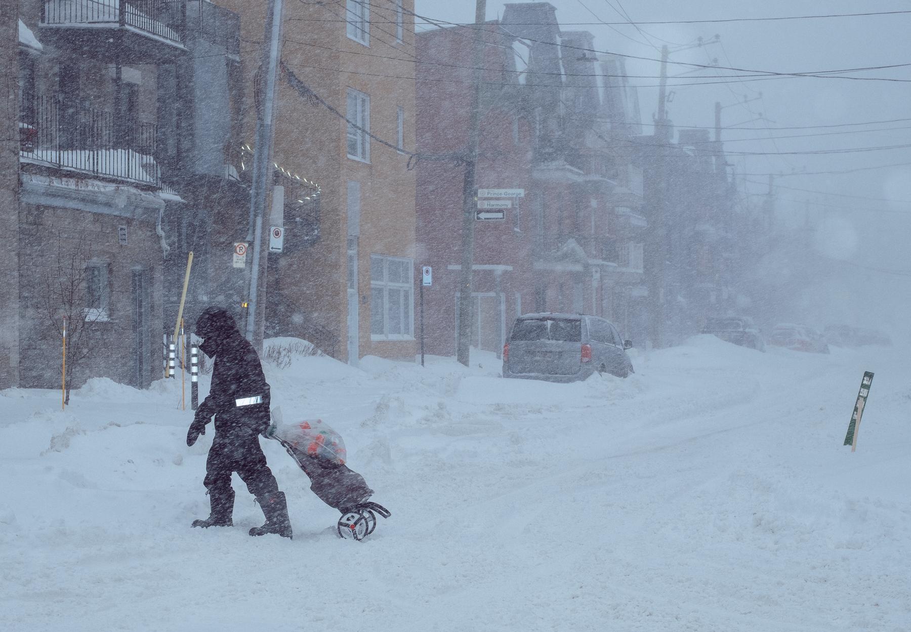
be brave, venture out! things are starting to get cleaned up now
we are opening on a rare Tuesday to make for all the snow days this week - come get a new jacket or some summer tops!
here till 5pm


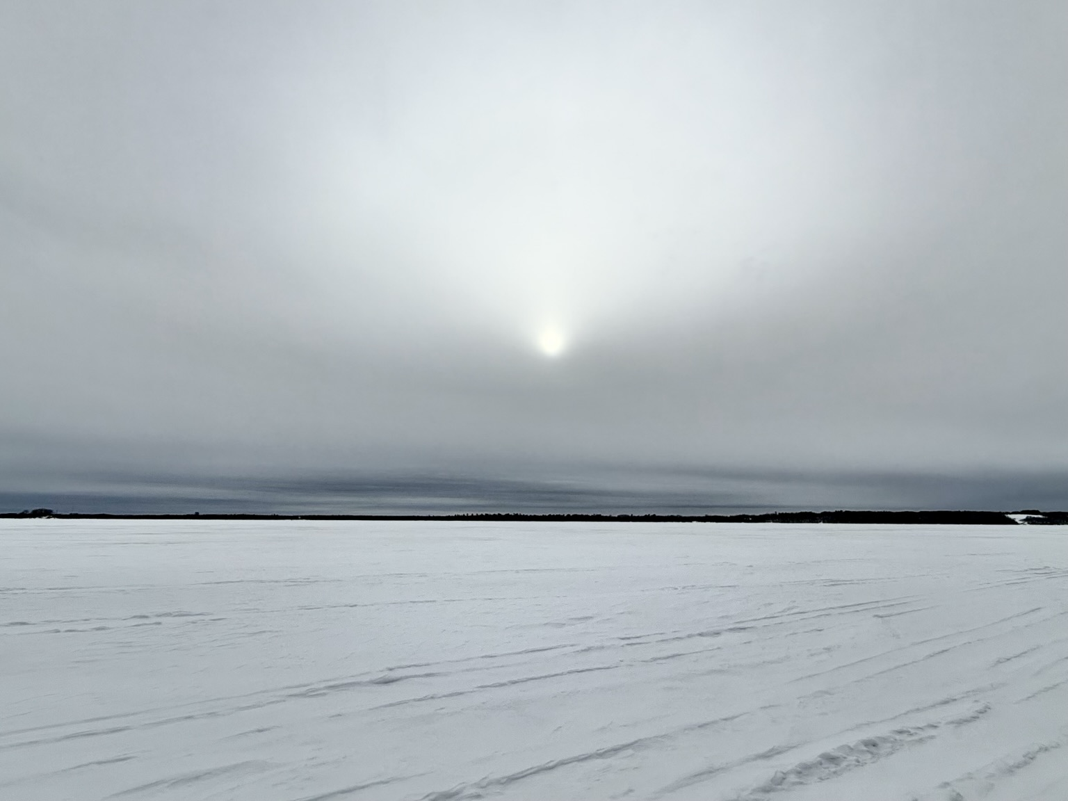
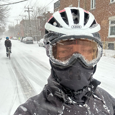
#SnowStorm right here in River City.
NWS Wakefield promises a forecast update at the end of the work day (1700R Tuesday). This is looking to be the real deal.
Not a lot of wind is expected. Just 1/3 meter of snow (300mm or 12 inches). With the storm track further south, it looks like we'll be on the cold side. No freezing rain for us in the guidance. Forecast guidance for for a medium-dense snow. Not powder but not Italian ice either. Just a nice snow forts and sledding snow.
NWS Wakefield Boffins report that they have an updated storm brief coming at 0900R.
Radio has finally realized it needs to read the 2nd paragraph of its contract forecast.
Contractor had split the snowfall by days. Radio was reading only the opener of what will be a twi-night double header.
Endless small flakes.
It has been snowing here all day. They say it's supposed to keep this up until 5pm tomorrow.
Contrary to every other forecast they give us, they're almost never wrong about how long our snow storms last.
Instead of the gym for exercise tomorrow, I guess we'll be flinging snow.
I'm trying to remember why I thought it was a good idea to retire somewhere that still has all four seasons. 

* WHAT...Heavy mixed precipitation possible.
Total snow accumulations between 5 and 10 inches and ice accumulations of up to one-tenth of an inch possible.
Winds could gust as high as 35
mph.
* WHERE...
Portions of northeast North Carolina and eastern and southeast Virginia.
* WHEN...
From Wednesday morning through Thursday afternoon.
* IMPACTS...
Travel could be very difficult.
The hazardous conditions could impact the Wednesday morning and evening commutes.
Boffins have enhanced the forecast— snow accumulation increased. Dryer snow expected. Colder temperatures expected. #VAwx #SnowStorm
https://www.weather.gov/media/akq/briefings/LatestBriefing.pdf


The snow storm coming in during a long weekend does give the rare opportunity to fursuit outdoors without worrying about dirty snow!
Though I really should have worn actual snow boots.

I've read through the AKQ storm brief. Dismal Dominion.
The Seven Dismal Sisters are going to catch it.
8-12 inches
snow character is to be heavy and wet.
Worst snow east of I-95 and south of I-64 with snow to start midday Wednesday and ending by midmorning Thursday.
Help seniors with shoveling.
Shovel out fire hydrants and storm drains.
Remember black ice is a thing.
And going is easy; stopping is hard.
#VAwx #SnowStorm
https://www.weather.gov/images/akq/winter/StormTotalSnowWeb_VA.jpg
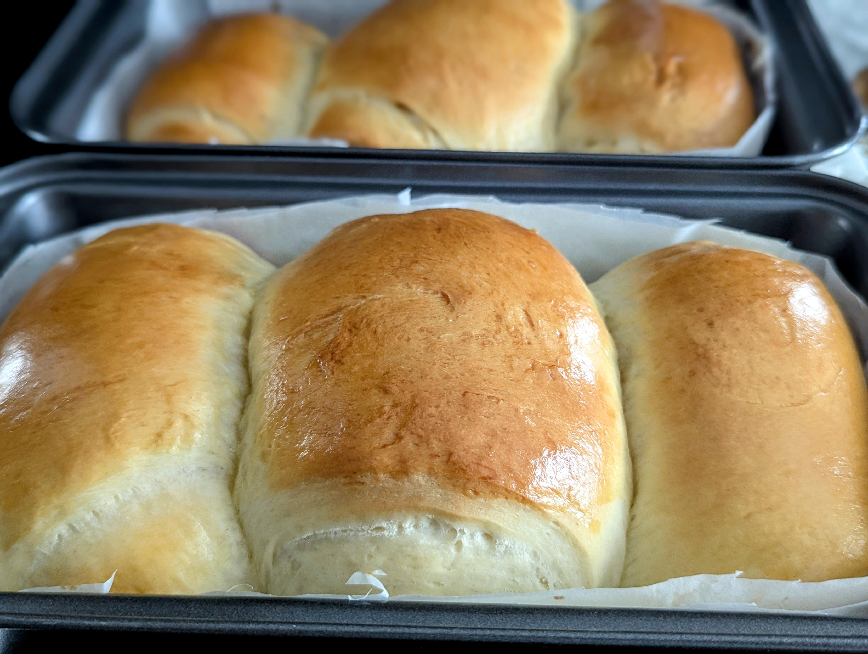
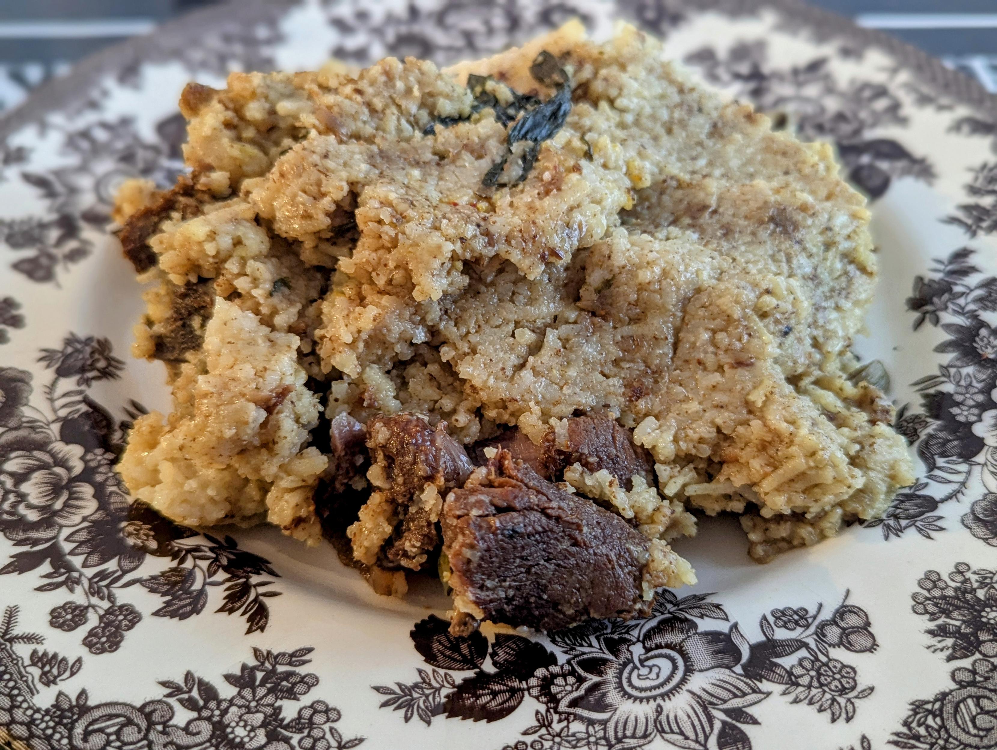
Yesterday was the second day of 30cm+ of snowfall last week. Made it a productive day of cooking; super soft milk bread, butternut squash and carrots soup and biryani!
#SnowStorm #Ottawa #Cooking #ButternutSquash #Biryani #Homemade #Bread


 FC2025